Mago Tawang is a high-altitude border village in Arunachal Pradesh. One of the least-visited places in the Indian Himalayas you can actually reach by road. Most people planning a Tawang trip never hear its name. Those who do usually wonder if it’s worth the detour but it’s not for everyone, and knowing the difference before you go saves a wasted day.
Mago is not for every Tawang itinerary, but it should be on more of them. If your trip is three days and full, skip it. The monastery, Bumla Pass, and Sela Pass already make for a complete trip. This complete guide covers location, how to get there, permits, the best time to go, what to do, and what to realistically expect. No filler, just what you need.
Where Is Mago and What Makes It Different
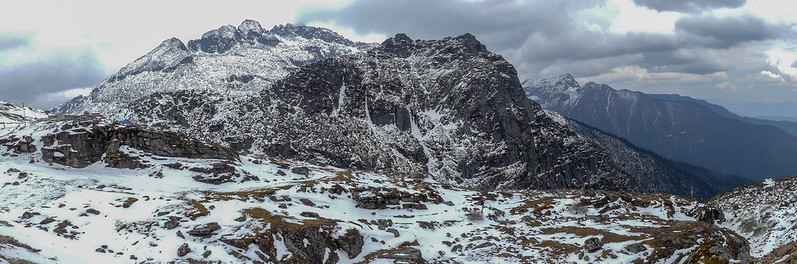
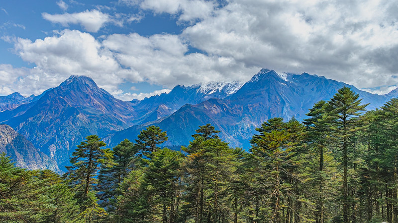
Mago is not a tourist attraction. It’s a working village at the edge of India. It sits at 3,520 metres above sea level in the Thingbu Circle of Tawang district. About 85 km from Tawang town in the eastern part of the district. The terrain is high, eroded, and raw. Rocky peaks on three sides, river gorges below.
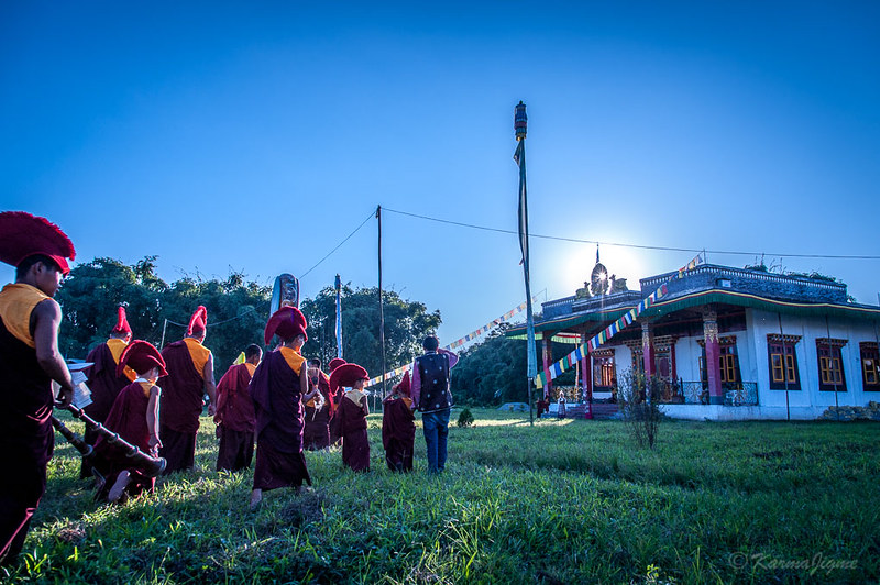
The village is small. About 486 people live here across 75 households, most from the Monpa community. Yak herding is the main way of life. In summer, herders push further up into alpine pastures. The village is home to over 1,000 yaks. During the right season you’ll see them moving through the valley. That’s not a scenic backdrop, that’s how people earn a living here.
What makes Mago village’s Tawang distinct from other stops on the Tawang circuit is the river junction. Three rivers meet here: the Goshu Chu, the Dungma Chu, and the Gorjo Chu. Their confluence forms the Mago Chu, which feeds into the Tawang Chu system. The village exists at this point because the water does. No monastery circuit, no tea shops with menus in Hindi. Just altitude, rivers, and a community that has been here far longer than any tourist route.
How to Reach Mago from Tawang
Drive 85 km from Tawang town, plan for 4 to 5 hours. You need a proper 4WD vehicle. A standard car will not handle the road past Jang.
There are two route options. Most people take the cave road via Jung, New Maling, and Thingbu. This road follows the Mago Chu river through a narrow gorge. The BRO carved it through cliff faces in C-shaped caverns. Each cavern opens on one side. The river runs below. It’s the first completed stretch of the Arunachal Frontier Highway, a proposed 2,000 km border road. The drive is slow, the road is single-lane in parts. But the engineering is unlike anything else in Tawang district.
The second option goes via Damteng and crosses high-altitude terrain past Gongkar La Lake along the India-China border. This is an off-road ride, not a road trip. It suits people with adventure driving experience and the right vehicle. The views are bigger, the risk is also bigger.
Route | Via | Condition | Best For |
Cave road | Jung, New Maling, Thingbu | Black-topped, single-lane sections | First-time visitors, standard SUV |
Damteng route | Damteng, Gongkar La | Off-road, high altitude, glaciated terrain | Experienced off-road drivers |
Leave Tawang town early. By 7 AM is sensible. Army checkpoints on the way will note your vehicle details and IDs. This is normal for a border district. Not a delay worth stressing over. But it adds time if you arrive at a checkpoint during a shift change.
Permits Required to Visit Mago
You need an ILP, that’s the main document. An Inner Line Permit is required for all Indian citizens entering Arunachal Pradesh. This single permit covers your visit to Mago. In 2026, the fee is around 100 rupees for up to 3 days. Longer stays up to 14 days cost 500 rupees. Apply online at eilp.arunachal.gov.in before your trip. Same-day processing on most applications. Foreign nationals need a Protected Area Permit instead. This requires traveling as a group of at least two people through a registered tour operator. Solo foreign travel to this region is not allowed.
Mago sits close to the India-China border, army checkpoints are part of the route. Your ILP, a government-issued photo ID, and your vehicle registration details will all be checked. Bring physical copies. Digital copies on your phone are not always accepted at remote checkpoints. Why does this matter? Because returning to Tawang for a missing document adds three hours to your day. Experienced local drivers know the routine. If you’re self-driving, have everything ready and be patient.
Best Time to Visit Mago Tawang
There’s no single best month, it depends on what you’re going for. Spring April to May is considered the best time to visit Mago Tawang for first time visitors.
Season | Months | Conditions | Verdict |
Spring | April to May | Clear skies, mild days, snow still on peaks | Good for first visits |
Summer / Monsoon | June to September | Green valleys, wildflowers, rain risk on cave road | Best for keeda jadi season; road risk in July-August |
Autumn | October to November | Dry roads, cold nights, clear mountain views | Best overall |
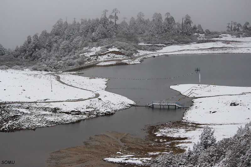
Winter | December to March | Heavy snow, possible road closures | Experienced cold-weather visitors only |
June and July have one angle no other guide covers. This is when caterpillar fungus, known locally as keeda jadi, grows in the high-altitude meadows near Mago. It’s a parasitic fungus that grows on moth larvae and carries high value in traditional medicine. The Monpa community harvests it during these weeks. Some visitors come specifically for this window.
What the rain does to the cave road in July and August is worth naming clearly. The road is carved into cliff edges above the river. In dry conditions, it’s dramatic. In monsoon conditions, water runs off the cliff face, the road surface narrows with runoff, and visibility drops. Not impossible. But genuinely hazardous for anyone not used to mountain driving. October and November are the cleanest months for the drive. Dry roads, cold air, sharp skies. Go in this window if you have a choice.
What to See and Do in Mago Village
The hot springs are not a bonus here, they’re the main event. Mago has two perennial hot springs on the bank of the Goshu Chu river. The Topkey hot spring is the standout, the water is clear, the flow is consistent and the pool is large enough to soak in. The temperature is right for a long sit. Open terrain and Himalayan ridgeline above you on all sides. No entry fee, no facilities, no changing room and a geothermal pool in the mountains
Two trekking trails start from Mago for those who want to go further on foot. The first follows the Dungma Chu river toward Jethang. The second runs along the Mago Chu toward Thingbu. Both are river canyon routes with no technical climbing. Sounds like easy walks? They’re not. The altitude is real, the ground is uneven, neither trail is marked the way a tourist route would be. Tell your driver where you’re going and set a return
Chuna Valley sits 12 km from Mago by road. It’s home to the Brokpa community, traditional yak herders living at higher altitude than Mago itself. Yak cheese here is made the old way. Not packaged, not processed. If you have a second half-day or an overnight in Mago, this extension makes sense. Most day-trip visitors skip it because of the return drive to Tawang. That’s fair. But if you’re already staying, go.
Where to Stay and What to Eat in Mago
Most visitors do Mago as a day trip from Tawang. Honestly, that’s the right call for most itineraries. Rooms in Mago are limited. There’s a state government guest house and a few home stays. Basic rooms, no hot water from a tap, no restaurant. You sleep, the family cooks, you eat what’s there. Rice, dal, and whatever is seasonal. Yak-based dishes can come up during the grazing season. Don’t plan around it though.
If you stay overnight, bring food from Tawang. No shops in Mago stock packaged goods. No dhaba row, no convenience store, and nothing of that kind. The home stay will feed you. But carrying your own snacks and something for the morning removes any logistical stress from the trip.
There are no ATMs in Mago. The nearest machine is back in Tawang town, 85 km away. Carry all cash before you leave, not a detail to leave until the last minute.
Practical Tips Before You Go
The drive looks short on a map, the road tells a different story. Four to five hours of mountain driving at altitude is tiring. Factor in the early start, the checkpoint stops, and the return trip the same day. A Mago day trip is a full twelve-hour commitment. Worth knowing before you slot it into a packed Tawang schedule.
Mago sits at 3,520 metres, Tawang town is at about 3,048 metres. The jump is not dramatic, but it’s real. People who flew into Guwahati, drove straight to Tawang, and hit Mago the next morning report more fatigue and headaches. Those who spent an extra night in Tawang first don’t. One buffer day changes how the trip feels. Completely.
Before you go, cover these six things:
- Apply for your ILP at eilp.arunachal.gov.in at least 2 days ahead of your trip date
- Carry physical copies of your ILP and a government ID, not just phone screenshots
- Withdraw enough cash in Tawang to cover fuel, any fees, and meals for the day
- Charge all devices the night before; there’s no charging point at Mago
- Pack warm layers even in summer; temperature drops fast after the sun hits the ridgeline
- As of 2026, there are no shops in Mago stocking packaged food; carry water and snacks from Tawang
Mobile signal is unreliable past Jang. In Mago itself, it’s gone. Download offline maps before leaving Tawang.
Conclusion
Trying to fit Mago on top means rushing all of it. But if you have a fourth day free, go. A working Monpa village at a Himalayan river junction beats another viewpoint. The cave road alone is worth it for the right person. The hot springs are genuinely good and this corner of Mago Tawang hasn’t been shaped by tourism yet. The visit feels different from most things you’ll do in Northeast India. That gap won’t last, go while it’s still like this.