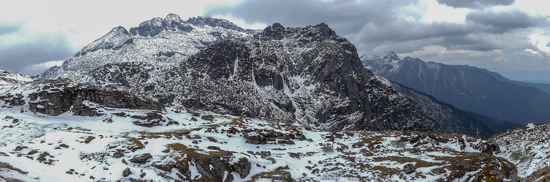
Sela Pass sits at 13,700 feet between Dirang and Tawang in Arunachal Pradesh. It is the high point of NH-13. Sela Pass Tawang is worth every bit of the drive. The people who feel let down are usually the ones who crossed without stopping. Or arrived without an ILP sorted. Or pushed straight through without a night to acclimatize.
For decades, crossing this pass was the only way into Tawang. The air thins fast up here, the road gets narrow. You round the last hairpin bend and reach the signboard at the top. Tawang stops being a name on a map, it starts feeling real.
This guide covers what to expect at the pass, when to go, and how to get there. It also covers something most travel articles skip. That is the choice between the old pass road and the Sela Tunnel, which opened in March 2024.
What Is Sela Pass and What to Expect When You Get There
Most people underestimate how short their time at Sela Pass will actually be. You picture a high-altitude viewpoint where you walk around and take your time. What actually happens is this: you step out of the vehicle. The cold hits harder than you expected. You walk to the signboard, take photos, maybe look out at the lake if visibility is good. Then you get back in. That is a typical stop of about 20 to 30 minutes.
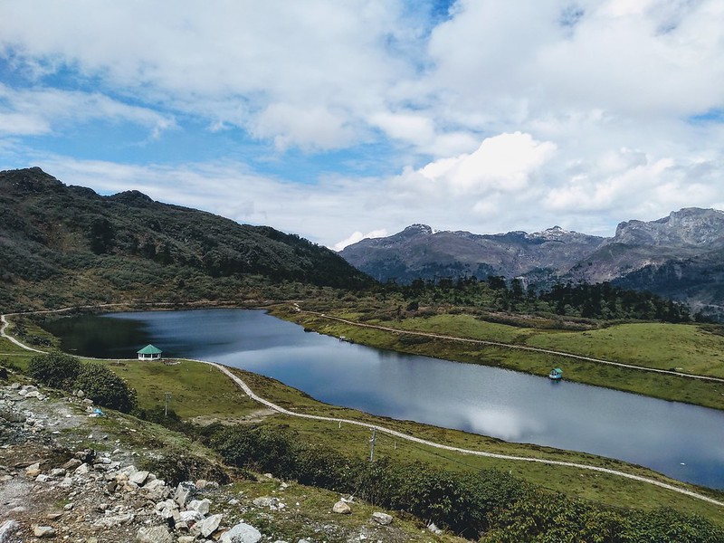
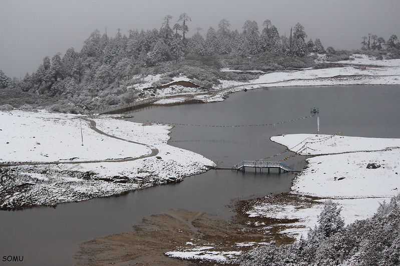
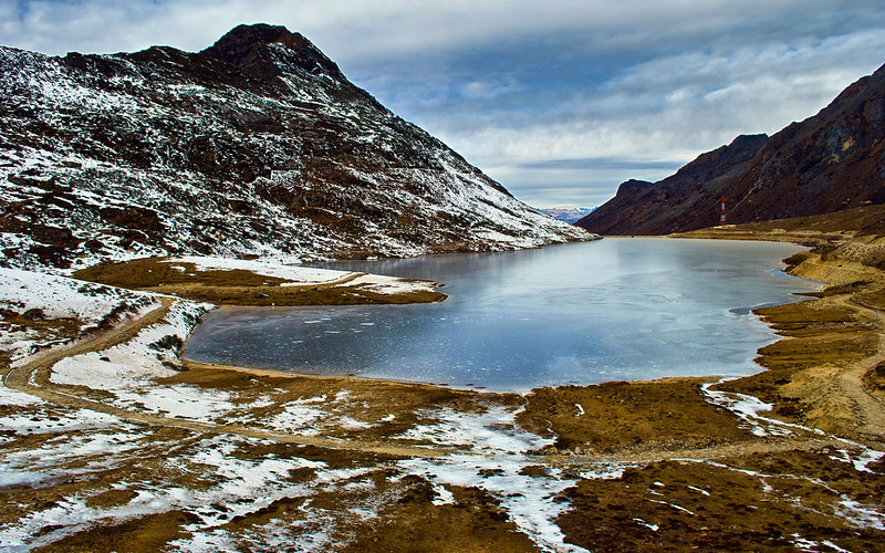
This is not a complaint about the place, the view is real. Sela Lake sits right at the base of the pass at 13,650 feet. It freezes solid through winter. In summer it turns a deep grey-blue. On a clear October day, the Himalayan range behind it is the kind of view that makes people go quiet. But at 13,700 feet, your body does not want to linger. Breathlessness sets in faster than most people expect and the cold cuts through even in May.
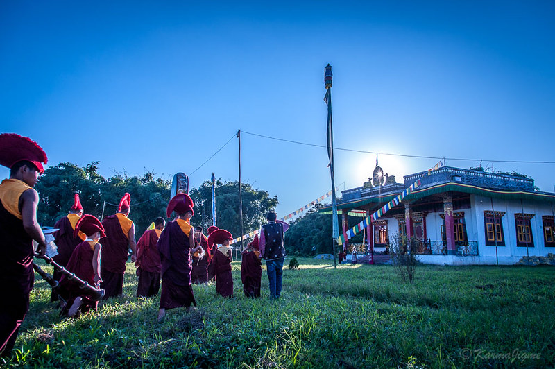
The 38 Battalion of the Sashastra Seema Bal manages a small cafeteria at the pass. It sells tea, Maggi, and basic snacks. It is the only food stop for the next 78 km toward Tawang. The Indian Army also keeps a medical point here. That second fact is worth noting. It is not there for decoration. Altitude trouble happens often enough to justify permanent medical cover at this site. Know this, plan your stop short, and do not push for a longer walk if your head is already aching.
Best Time to Visit Sela Pass
The best time to visit Sela Pass is not the same as the best time to visit Tawang. April and October are the best months for the pass specifically. April brings snow on the higher peaks. Rhododendrons bloom in the Dirang valley below on the way up. The contrast between the snow line above and the flowers below it is striking. October gives the clearest skies of the year. No snow on the road surface, good visibility, and the Himalayan range visible without haze. Both months give you the pass at its most cooperative.
Here is how each season plays out at the pass:
Season | Conditions at Pass | Road Risk | Best For |
March to May | Snow on peaks, flowers in valley, 2–10°C daytime | Low to moderate | Photos, scenic drive, spring blooms |
June to September | Fog and rain likely, landslide risk on approach | Moderate to high | Possible but plan around weather windows |
October to November | Clearest skies, dry road, 0–8°C daytime | Low | Views, photography, clean roads |
December to February | Heavy snow, pass may close 1–2 days after snowfall | High in winter | Snow lovers willing to check road status daily |
The June to September window trips people up. The pass itself may be fine on a given day. But the Dirang-to-Sela approach road gets landslides during monsoon. The BRO works to keep NH-13 open year-round, but shutdowns happen with little warning. Build a buffer day into any monsoon-season plan.
How to Reach Sela Pass from Tawang: Distance, Roads, and Route
Sela Pass sits 78 km from Tawang. The drive takes longer than that number suggests. On a clear day, the stretch from the pass down to Tawang takes 3 to 4 hours. The road narrows in sections. The descent is steep in places. Army vehicles and buses add time. If you are driving up from Dirang toward the pass, the full Dirang-to-Tawang stretch is about 130 km. That takes 6 to 7 hours, leave Dirang no later than 7am if you want Tawang before dark.
The tawang to sela pass distance works in your favor heading back toward Dirang. You are already at altitude. The descent is the easier direction, the 78 km goes from Tawang up through the pass and down to Dirang. The road on the Tawang side is in better shape. On the Dirang side, the surface breaks up more. Higher rainfall and the altitude shift take a toll on the asphalt.
What about the sela pass to tawang distance for people joining from further away? The table below covers the main starting points:
Starting Point | Distance to Pass | Approx. Drive Time | Notes |
Tawang | 78 km | 3–4 hours | Better road on Tawang side |
Dirang | 55 km | 2.5–3 hours | Rougher road near the pass |
Bomdila | 130 km | 5–6 hours | Via Dirang, add time for a stop |
Tezpur | ~320 km | 10–12 hours | Full-day drive, overnight stop advised |
The nearest railway station is Rangapara North, about 340 km from Tawang. Tezpur is the most common road starting point for people coming from Assam. A hired car is the standard choice. Public buses run the route but stop often. They do not suit the timing you need when road and pass conditions vary.
Inner Line Permit: What You Need Before You Go
You need an Inner Line Permit to enter Arunachal Pradesh. Getting one takes less than 15 minutes online. The eILP portal is eilp.arunachal.gov.in. Indian nationals apply there before the trip. The fee in 2026 is Rs. 300 for up to 3 days and Rs. 500 for up to 14 days. Children under 14 with an adult are exempt. The permit is checked at Bhalukpong, the main entry point from Assam.
Foreign nationals need a Protected Area Permit in addition. This involves more paperwork and official channels. Do not leave it late if you are a foreign national.
Here is what to sort before you leave:
- Apply online at eilp.arunachal.gov.in with your ID details
- Save a downloaded copy of the approved permit on your phone
- Carry original ID that matches the permit at all checkpoints
- Foreign nationals: contact the Foreigner Registration Office well ahead of travel
Most first-time visitors think they can sort the permit at Bhalukpong. Sometimes you can. But it slows you down and creates risk if paperwork is incomplete. Sort it at home.
Altitude Sickness at Sela Pass: What to Know Before You Climb
The Indian Army keeps a medical post at Sela Pass for a reason. At 13,700 feet, Acute Mountain Sickness is a real risk if you gain altitude too fast. People who fly into Guwahati and drive straight to Tawang are most likely to feel it. Skipping a night in Dirang or Bomdila is the common mistake. The body needs time to adjust. A night at Bomdila at about 8,500 feet gives your system a chance to catch up. A night in Dirang at around 4,900 feet adds another step. Skip both and you may reach the pass with a headache already building.
What does AMS feel like here? Headache is the first sign, then breathlessness beyond what the cold air explains, nausea is less common but happens. Symptoms can start before you reach the top. They get worse the longer you stay at altitude. This is why the recommended stop is 20 to 30 minutes, not an extended wander.
Sound overly cautious? The army medical post handles AMS cases here with some regularity. You are better off knowing this in advance. Finding out at 13,000 feet with the next town 60 km away is the worse lesson.
Take these steps to reduce risk: spend at least one night below 9,000 feet before the crossing. Drink water throughout the drive. Skip a heavy meal the morning you cross. Get back in the vehicle if you feel unwell, do not push through hoping it clears.
What to See At and Around Sela Pass
The most interesting stop near Sela Pass is not the pass itself. Sela Lake deserves 30 minutes. It sits right at the base of the summit, at about 13,650 feet. In winter it freezes solid and turns a pale blue-white. In warmer months it holds a deep grey-blue color, ringed by low scrub and rocky ground. It is also called Paradise Lake locally. You can walk down from the road to the edge when conditions allow.
But the Jaswant Garh War Memorial, about 30 km north toward Tawang, is the stop most people rush past. Jaswant Singh Rawat was an Indian Army soldier. He held off the Chinese advance alone for 72 hours during the 1962 war. He was helped by two local Monpa girls, Sela and Noora, Sela was killed and Noora was captured. Rawat held on until the Chinese found a supplier who told them only one fighter was defending the post.
The pass, the lake, and the tunnel are all named after Sela. The waterfall near Jang is called Nuranang Falls, named after Noora. That is not a footnote, It is the story behind every place name on this stretch of road. The memorial takes 30 minutes, read the boards. It changes how the rest of the drive to Tawang feels.
Here is how to sequence the stops:
Place | Distance from Pass | Time Needed | Note |
Sela Lake | At the pass | 20–30 min | Walk from road, easier in summer |
SSB Cafeteria | At the pass | 15–20 min | Tea and Maggi, only food before Tawang |
Jaswant Garh Memorial | ~30 km toward Tawang | 30 min | Do not skip this |
Nuranang Falls | ~50 km toward Tawang, near Jang | 20–30 min | Worth a stop if road conditions allow |
Packing and Practical Tips for Sela Pass
The view at Sela Pass is world-class. There is no phone signal at the pass on most networks. The SSB cafeteria is the only food option and it is not always open. Dirang is the last reliable ATM point before you head up. No fuel stations at the summit. The BRO closes the road after heavy snowfall, sometimes for 24 to 48 hours. These closures come with little advance warning outside BRO Project Vartak social media updates. These are not scare facts. They are the things worth knowing before you pack.
What to bring:
- Warm layers even in summer: pass temperature drops fast after midday
- A windproof jacket: regular fleece is not enough at the summit
- Cash: no ATM once you leave Dirang
- Water and snacks: do not rely on the cafeteria being open
- Fully charged phone with an offline map downloaded
- Any altitude medication your doctor has advised
What to know before you go:
- The pass is open 24 hours with no entry fee
- Temporary closures happen after heavy snowfall, check BRO Project Vartak updates in winter
- Tourist overnight stays at the pass are not allowed
- Road surface on the Dirang side is rougher than the Tawang side
Conclusion
Get the permit online before you leave home. Spend a night in Bomdila or Dirang. Decide whether the pass or tunnel suits your conditions. Stop at the lake, stop at Jaswant Garh. Drink the tea at 13,700 feet. The pass gives you something no other point on NH-13 does and slow down for it.