
14,107 ft
Nov-March Snow
5,000+ Trekkers
1:5 Ratio
80+ Batches
4.8/5
Valley Of Flowers Trek
A Journey Through India’s Most Stunning Himalayan Landscape
Valley of Flowers Trek: Overview
The Valley of Flowers trek runs through Uttarakhand’s Chamoli district, covers roughly 37 to 38 km on foot, and costs between ₹7,000 and ₹14,000 before extra fees. July to September is the only window it’s open. Most operators run it as a 6-day package from Rishikesh, though the trekking itself takes just four days.
This guide breaks down the real route, the real cost after add-ons, and which month actually fits what you want to see. No filler. Just the numbers and decisions you need before you book.
Trek Highlights
Click each reason to read the full story.
Many found nowhere else at this altitude, including Blue Poppy, Cobra Lily, and the rare Brahma Kamal.
The valley sits inside Nanda Devi and Valley of Flowers National Parks.
The meadow itself, the Hemkund Sahib climb, and the Pushpavati river crossing all deliver a genuinely different experience, and most people only plan for one.
A glacial lake beside one of the world’s highest Gurudwaras, sitting above 14,000 ft, turns Day 4 into something closer to a pilgrimage than a hike.
Flows through the entire route and crosses the trail on wooden bridges more than once; sit by it for ten minutes on Day 3, almost nobody does.
Unlike most treks above 11,000 ft, you walk straight into the best views, wh.ich makes this a rare high-reward pick for photographers and first-timers alike.
The park is open only from June to October, so the bloom you see is genuinely time-limited, not something you can plan for “whenever”.
Valley of Flowers Trek Quick Itinerary
| DAY | ROUTE | DISTANCE | DURATION | DIFFICULTY | WHAT YOU’RE DOING |
|---|---|---|---|---|---|
| 1 | Rishikesh to Govindghat | 255 km (drive) | 9–11 hrs | Easy | Long scenic drive along the Alaknanda River to basecamp |
| 2 | Govindghat/Pulna to Ghangaria | 9 km (trek) | 5–6 hrs | Easy–Moderate | Gradual river-side climb to basecamp village |
| 3 | Ghangaria to Valley of Flowers and back | 7–8 km (round trip) | 6–7 hrs | Easy | Flat meadow walk through the flower valley itself |
| 4 | Ghangaria to Hemkund Sahib and back | 12 km (round trip) | 8–9 hrs | Difficult | Steep high-altitude climb to the glacial lake and Gurudwara |
| 5 | Ghangaria to Pulna/Govindghat | 9 km (trek) | 5–6 hrs | Easy–Moderate | Descend back to the roadhead |
| 6 | Govindghat to Rishikesh | 255 km (drive) | 9–10 hrs | Easy | Return drive |
Quick stats: Distance: 255 km | Time: 9-11 hrs | Altitude: 640 m → 1,920 m
This is a road day, and there’s no way around that. You’ll cover around 255 km in 9 to 11 hours, following the Alaknanda River most of the way. Pickup is usually before 6 AM, so arrive in Rishikesh the night before, not the morning of.
The road hugs the mountainside past Pipalkoti, and the terrain shifts fast once you cross into the Greater Himalayan range. Watch for Mount Dronagiri once you’re close to basecamp. It’s visible from several points along the last stretch, and it’s near Reini, where India’s Chipko movement began in the 1970s.
Nothing technical happens today. Just sit back and watch the valley change shape outside the window. Most basecamps offer a cloakroom for extra luggage you won’t need on the trail. Use it. You’ll thank yourself on Day 2.
Quick stats: Distance: 9 km | Altitude: +1130 m | Time: 5-6 hrs
Drive from your basecamp to Pulna, then trek 9 km to Ghangaria. The trail follows the river the whole way, alternating between shade and open sun. You’ll share the path with Sikh pilgrims heading to Hemkund Sahib, and the trail stays surprisingly clean given how many people walk it daily. Local volunteers sweep it every morning. Small dhabas line the route, selling tea, biscuits, and packaged snacks, so you’re never far from a break point.
At the halfway mark, the trail crosses to the opposite riverbank and you lose sight of the water for the rest of the climb. Expect 5 to 6 hours on foot, more if you stop often for photos. Ghangaria itself sits on flat ground with a helipad, a Gurudwara offering free food and shelter to anyone who needs it, and a short strip of hotels and restaurants. This is your base for the next two nights.
Quick stats: Distance: 8 km | Altitude: +600 m | Time: 6-7 hrs
This is the payoff day, and it earns it. Leave Ghangaria early to give yourself the full day. The trail splits within the first kilometer, and you’ll pass through a ticketed entry gate before the meadow properly opens up. Walk in and notice how fast the terrain shifts. What starts as a defined path narrows into a footway along the valley wall, with the river running below and small snow patches clinging to the shaded slopes even in August.
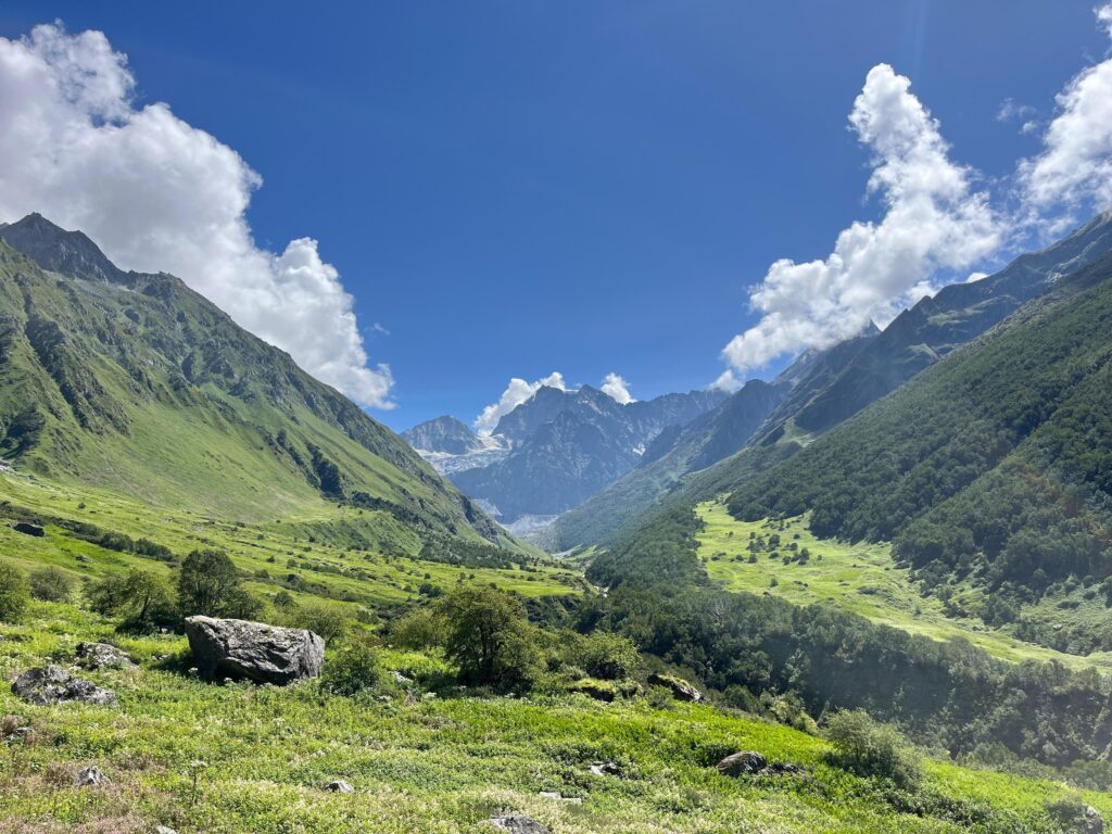
The valley opens into color once you clear the first ridge, roughly a kilometer past the second bridge. Greens, purples, yellows, and reds spread across the meadow floor in patches, framed by grey rock and white snow higher up. On a clear day, the sky adds a fourth color that makes the whole scene look staged. It isn’t.
Species shift by the week. In July and August, expect Meadow Geranium, Blue Poppy, Himalayan Rose, and Snake Foil, among dozens of others. The valley stretches another 5 to 7 km beyond the main meadow, ending at a glacier most trekkers never reach. If you have the legs for it, the extra stretch is quieter than anywhere else on the route.
Carry your own lunch. There’s no food available past the gate, and camping inside the park isn’t allowed under any circumstances. Round trip takes 6 to 7 hours, and the return walk in afternoon light looks different enough from the morning version that it’s worth the second look.
Quick stats: Altitude: 12,467 ft | Distance: 12 km | Time: 8-9 hrs
This is not an easy day. You’ll gain close to 4,000 ft over 6 km, much of it on a steep, switchback climb above 10,000 ft. Start before 5 AM. The Gurudwara’s morning prayers begin around 4 AM, and the sound often helps with the early wake-up more than any alarm does. Carry a poncho and a trekking pole. The air thins fast past the treeline, and altitude sickness risk goes up noticeably on this stretch. Watch for a waterfall on your right roughly two hours in. That marks the point where views open up and the trail starts feeling genuinely alpine.
Take breaks standing, not sitting. Sitting relaxes your legs just enough to make restarting harder, and on a climb this steep, momentum matters. A melting glacier crosses the path higher up. Move carefully there. The reward is a glacial lake beside one of the highest Gurudwaras in the world, ringed by snow-covered peaks and frozen solid for half the year. Rare Brahma Kamal flowers grow near the shrine in July and August, found only above 10,000 ft and nowhere inside the main valley itself.
Descent takes 4 to 5 hours and is harder on the knees than the climb was on the lungs. Leave by early afternoon. Weather here turns fast, and afternoon cloud cover is the rule, not the exception.
Quick stats: Distance: 9 km + 200 km | Altitude: -1130 m
Retrace your steps from Ghangaria to Pulna, 9 km, then drive back to your basecamp. It’s the same trail you walked on Day 2, seen from the other direction, and most trekkers find it easier than expected since the altitude drops with every step. Breakfast at Ghangaria, then a steady 5 to 6 hour descent.
Quick stats: Distance: 255 km | Altitude: -1550 m
Retrace your steps from Ghangaria to Pulna, 9 km, then drive back to your basecamp. It’s the same trail you walked on Day 2, seen from the other direction, and most trekkers find it easier than expected since the altitude drops with every step. Breakfast at Ghangaria, then a steady 5 to 6 hour descent.
Valley of Flowers Trek Cost: Complete Pricing Breakdown
No ranges. No “starting from” estimates. Here is the exact cost.
Total minimum cost: Rs 8,000 per person (trek fee + insurance). Offloading and cloakroom are optional.
What Is Included
- Accommodation at the basecamp and in Ghangaria lodges
- All meals from Day 1 dinner through Day 6 breakfast
- A trek leader and local guides, forest permits, and basAc medical gear including a first aid kit and oxygen cylinders.
What Is Not Included
- Transport if you’re not booking it through the operator
- Personal rental gear like jackets and backpacks, mule or porter charges for offloading
- Any medical costs incurred during the trek, and trek insurance in a handful of budget packages, though most now include it as standard.
6 days (Rishikesh to Rishikesh) |
Upcoming Batches
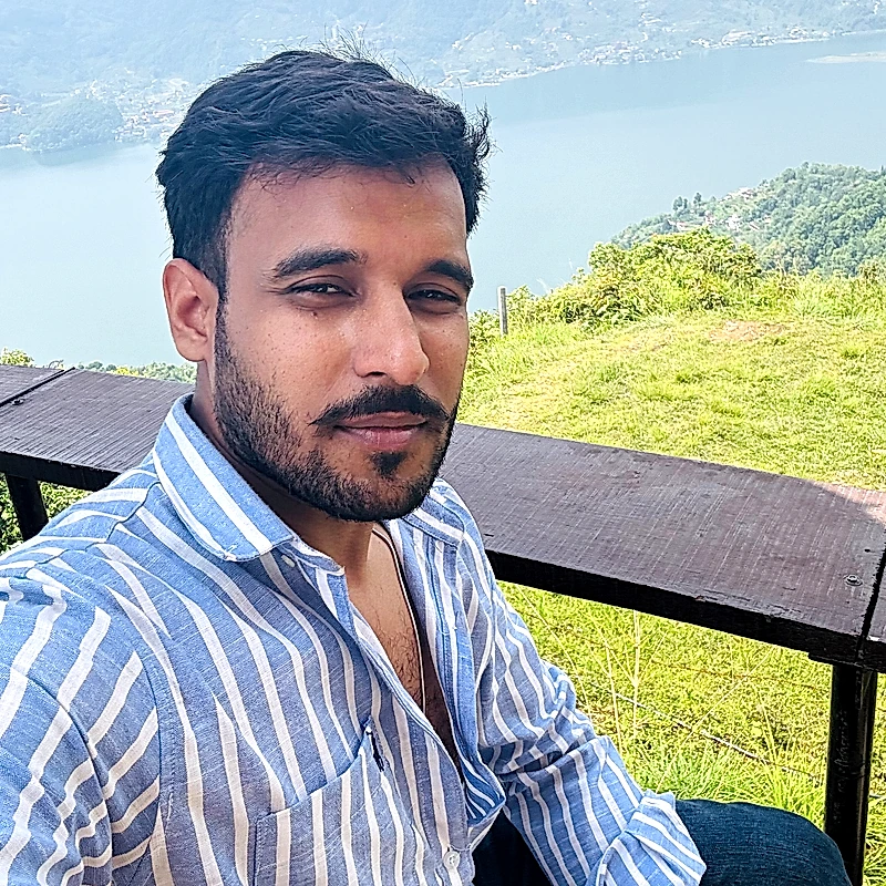
“I started Kedarkantha Trek because the mountains changed my life, and I wanted to make that transformation accessible to anyone willing to walk. Every trail we run, I ask: would I send my own family on this batch?”
Ritesh Mishra
Founder, kedarkanthatrek.in • 12 years in Himalayan trekking
What Trekkers Say About the Kedarkantha Trek
Aggregate Rating: 4.8 / 5 (based on 127 verified reviews). These are unedited accounts from trekkers who completed the Kedarkantha trek with us. Names and details shared with permission.
Valley of Flowers Trek: Frequently Asked Questions
Is the Valley of Flowers trek good for first-timers?
Yes. It’s one of the more beginner-friendly Himalayan treks on offer, provided you take Day 4 seriously and train for it specifically rather than assuming the whole trek matches its easy-moderate label.
How long is the Valley of Flowers trek?
Most packages run 6 days including travel from Rishikesh, with 4 of those days spent actually trekking. The walking distance across those 4 days lands close to 38 km.
Is trekking during monsoon actually safe?
Yes, when operators plan around it properly. Landslides and roadblocks happen more often this time of year, which is why buffer days matter. The trail itself, once you’re walking it, is generally well-maintained and regularly monitored during the open season.
Can I do the Valley of Flowers trek solo, without an operator?
Yes, though most trekkers still book with a group for the permits, transport, and safety support. If you go independently, you’ll need to arrange your own permits at Ghangaria and handle transport, accommodation, and food yourself.
What's the highest point on the trek?
Hemkund Sahib, at 14,107 ft. The Valley of Flowers itself tops out closer to 11,500 ft.
Do I need prior trekking experience?
No. Basic fitness matters more than prior experience. Someone with no trekking background but solid cardiovascular fitness will handle this better than an experienced trekker who skipped training.
Is mobile network available on the trek?
Barely. Jio and Airtel work intermittently up to Govindghat and occasionally in Ghangaria, but there’s no reliable signal inside the Valley of Flowers National Park itself. Tell family your plans before you lose signal, not after.
Can children do this trek?
Yes, depending on the operator’s minimum age, usually somewhere between 9 and 14. Kids need to walk the distance themselves in most cases, since pony and porter options for children are limited on the steeper Hemkund stretch.
What happens if it rains heavily during the trek?
Trek leaders monitor conditions daily and can reroute, delay, or in rare cases cancel a day’s plan if rain makes a section unsafe. Bridges over the Lakshman Ganga are the usual concern, since heavy rain increases the flow fast. Most operators recommend visiting the valley in the morning and returning by early afternoon for exactly this reason.
Is the Valley of Flowers trek suitable for senior citizens?
Often yes, with some caveats. Fit seniors regularly complete this trek, but most operators require a recent cardiac test for anyone above 58, given the strain Day 4 puts on the heart at altitude.
Treks Similar to Kedarkantha: What to Do Next
Brahmatal Trek
Brahmatal’s summit sits at 12,250 feet, just 250 feet lower than Kedarkantha. The trekking distance is longer at 22 km across 4 trekking days. The trail passes two frozen lakes instead of one. The mountain views are different: Trishul and Nanda Ghunti dominate the skyline instead of Swargarohini and Bandarpoonch. If you loved the snow and summit experience on the Kedarkantha trail and want a similar challenge with new scenery, Brahmatal is the natural next step. Best done in January or February.
Har Ki Dun
Har Ki Dun runs 7 days and covers 45 km through the same national park. Both treks start from Sankri. The difficulty is comparable, but the longer duration tests endurance more than altitude. The route follows the Supin River through ancient Garhwali villages. Swargarohini appears up close from the valley floor. If you want to go deeper into the same mountain range, this is the trek.
Dayara Bugyal
Dayara Bugyal is a high-altitude meadow trek that peaks at around 11,800 feet. The gradient is gentler than Kedarkantha. The meadows are wider. No steep summit push. If you are trekking with children under 8 or family members who prefer rolling green terrain over snow and summits, Dayara Bugyal is the safer introduction.
Deoriatal Chandrashila
Deoriatal Chandrashila combines a lake, a temple (Tungnath), and a summit (Chandrashila, 13,123 ft). The trek is 6 days and mixes cultural stops with mountain trail. If you want more variety in terrain and experience types than Kedarkantha offers, this trek delivers that range.
